Imatge:Ob watershed.png
De Viquipèdia
No hi ha una versió amb una resolució més gran.
Ob_watershed.png (300 × 300 píxels, mida de l'arxiu: 18 KB, tipus MIME: image/png)
| | Aquest arxiu és una càrrega compartida, extreta del projecte Wikimedia Commons i pot ser usada per altres projectes. Si voleu disposar de més informació sobre el fitxer, podeu visitar la pàgina original |
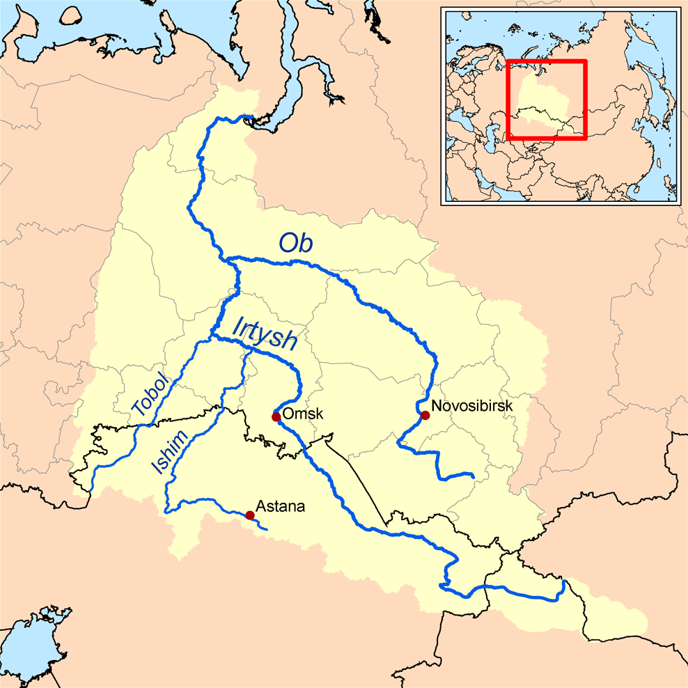
This is a map of the Ob River Watershed (at the confluence with the Irtysh river). I, Karl Musser, created it based on USGS data.
|
Historial del fitxer
Cliqueu sobre la data/hora per veure el fitxer tal com era aleshores.
| Data/Hora | Dimensions | Usuari | Comentari | |
|---|---|---|---|---|
| actual | 20:12, 10 abr 2006 | 300×300 (18 KB) | Kmusser | (This is a map of the Ob River Watershed. I, Karl Musser, created it based on USGS data. {{GFDL}} Category:Maps of rivers) |

