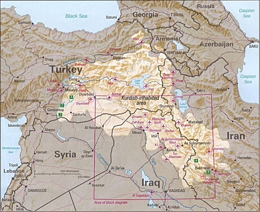
Imatge:Kurdish-inhabited area by CIA (1992).jpg
De Viquipèdia
Mida d'aquesta previsualització: 734 × 599 píxels
Imatge en màxima resolució (982 × 802 píxels, mida de l'arxiu: 630 KB, tipus MIME: image/jpeg)
| | Aquest arxiu és una càrrega compartida, extreta del projecte Wikimedia Commons i pot ser usada per altres projectes. Si voleu disposar de més informació sobre el fitxer, podeu visitar la pàgina original |
Summary
Kurdish-inhabited area by CIA (1992)
- Source: Perry-Castañeda Library Map Collection at The University of Texas at Austin [1]
- License: Above a list of maps available for download, the web site has the text: The following maps were produced by the U.S. Central Intelligence Agency, unless otherwise indicated.. There is no indication that this map was not produced by the CIA.
Περίληψη
Περιοχές κατοικούμενες από Κούδρους CIA (1992)
- Πηγή: Perry-Castañeda Library Map Collection at The University of Texas at Austin [2]
License
| This image is a work of a Central Intelligence Agency employee, taken or made during the course of the person's official duties. As a Work of the United States Government, all images created or made by the CIA are in the public domain, with the exception of classified information. |  |
Historial del fitxer
Cliqueu sobre la data/hora per veure el fitxer tal com era aleshores.
| Data/Hora | Dimensions | Usuari | Comentari | |
|---|---|---|---|---|
| actual | 20:21, 9 feb 2007 | 982×802 (630 KB) | White Cat | ('''Kurdish Lands (location map) 1992''' *Source: Perry-Castañeda Library Map Collection at The University of Texas at Austin [http://www.lib.utexas.edu/maps/middle_east.html] *License: Above a list of maps available for download, the web site has the te) |
Enllaços a la imatge
Les següents pàgines enllacen a aquesta imatge:

