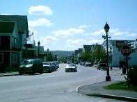
Fort Kent
|
|
Cet article est une ébauche concernant une localité du Maine (États-Unis). Vous pouvez partager vos connaissances en l’améliorant (comment ?) selon les recommandations des projets correspondants.
|
| Fort Kent | ||||||||||||||
 |
||||||||||||||
| Administration | ||||||||||||||
|---|---|---|---|---|---|---|---|---|---|---|---|---|---|---|
| Pays | ||||||||||||||
| État | ||||||||||||||
| Comté | Aroostook | |||||||||||||
| Type de localité | Town | |||||||||||||
| Code ZIP | 04743, 04744 | |||||||||||||
| Démographie | ||||||||||||||
| Population | 4 097 hab. (20100) | |||||||||||||
| Densité | 29 hab./km2 | |||||||||||||
| Géographie | ||||||||||||||
| Coordonnées | 47° 14′ 55″ N 68° 34′ 55″ O / 47.248611, -68.58194447° 14′ 55″ Nord 68° 34′ 55″ Ouest / 47.248611, -68.581944 | |||||||||||||
| Altitude | 186 m | |||||||||||||
| Superficie | 14 340 ha = 143,4 km2 | |||||||||||||
| · dont terre | 140,3 km2 (97,84 %) | |||||||||||||
| · dont eau | 3,1 km2 (2,16 %) | |||||||||||||
| Fuseau horaire | EST (UTC-5) | |||||||||||||
| Localisation | ||||||||||||||
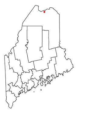 Carte du comté d'Aroostook |
||||||||||||||
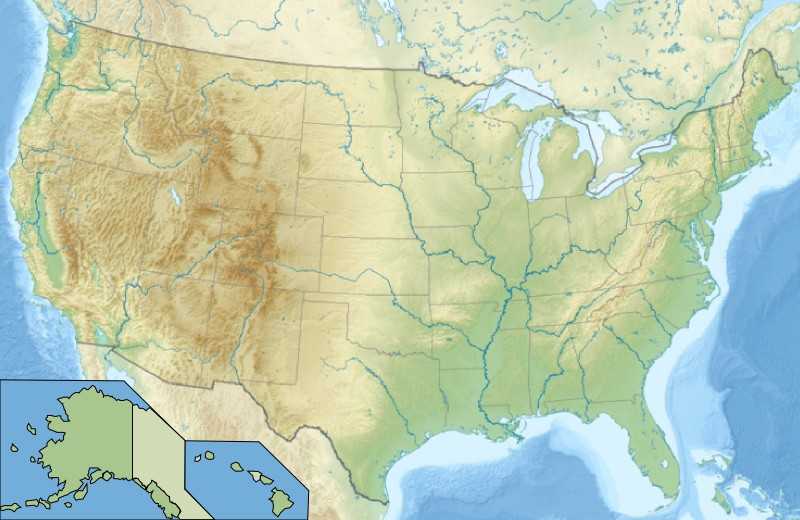
| Géolocalisation sur la carte : Maine
Géolocalisation sur la carte : États-Unis
Géolocalisation sur la carte : États-Unis
| ||||||||||||||
| Liens | ||||||||||||||
| Site web | http://www.fortkent.org | |||||||||||||
| modifier | ||||||||||||||

Fort Kent est une ville située dans l’État américain du Maine, dans le comté de Aroostook.
Population
Selon le recensement de 2010, sa population est de 4 097 habitants. On estime que 62 % de la population parle le français[1].
Géographie
Cette section est vide, insuffisamment détaillée ou incomplète. Votre aide est la bienvenue !
Le village se situe en face de la commune canadienne de Clair, dans le Nouveau-Brunswick.
Histoire
Fort-Kent est l'une des localités organisatrices du Ve Congrès mondial acadien en 2014[2].
Économie
Cette section est vide, insuffisamment détaillée ou incomplète. Votre aide est la bienvenue !
Culture
Cette section est vide, insuffisamment détaillée ou incomplète. Votre aide est la bienvenue !
Monuments et patrimoine
Cette section est vide, insuffisamment détaillée ou incomplète. Votre aide est la bienvenue !
En 1968, l'artiste américain Dennis Oppenheim a réalisé son œuvre Annual Rings sur la glace de la St. Johns River séparant le Canada des États-Unis.
Notes et références
- ↑ http://www.francomaine.org/English/Carto/cartes/Aroos_Th4.htm
- ↑ « Programme officiel » [PDF], sur Congrès mondial acadien 2014 (consulté le 11 août 2014)
 Portail des Franco-Américains
  Portail de l’Acadie
  Portail du Maine
  Portail de la langue française et de la francophonie
This article is issued from Wikipédia - version of the Wednesday, May 06, 2015. The text is available under the Creative Commons Attribution/Share Alike but additional terms may apply for the media files.