Imatge:Tannenberg3008.jpg
De Viquipèdia
Mida d'aquesta previsualització: 775 × 600 píxels
Imatge en màxima resolució (1.242 × 961 píxels, mida de l'arxiu: 207 KB, tipus MIME: image/jpeg)
| | Aquest arxiu és una càrrega compartida, extreta del projecte Wikimedia Commons i pot ser usada per altres projectes. Si voleu disposar de més informació sobre el fitxer, podeu visitar la pàgina original |
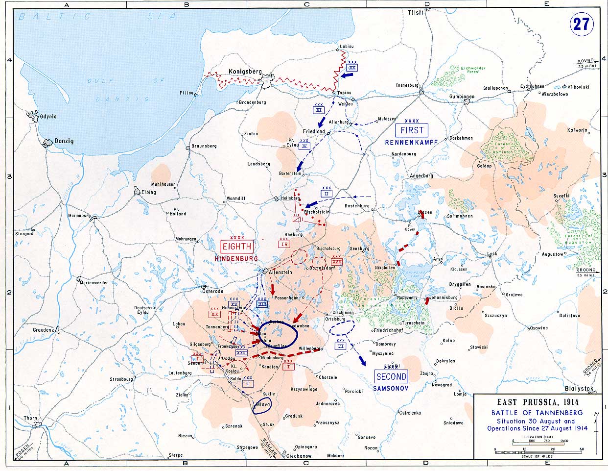
Taken from the campaign series, made public by the US-Army under www.dean.usma.edu The picture is public domain. It shows the Battle of Tannenberg (1914) in its last phase
- Source: dean.usma.edu
From website:
- In 1938 the predecessors of what is today The Department of History at the United States Military Academy began developing a series of campaign atlases to aid in teaching cadets a course entitled, "History of the Military Art." Since then, the Department has produced over six atlases and more than one thousand maps, encompassing not only America’s wars but global conflicts as well.
- In keeping abreast with today's technology, the Department of History is providing these maps on the internet as part of the department's outreach program. The maps were created by the United States Military Academy’s Department of History and are the digital versions from the atlases printed by the United States Defense Printing Agency. We gratefully acknowledge the accomplishments of the department's former cartographer, Mr. Edward J. Krasnoborski, along with the works of our present cartographer, Mr. Frank Martini.
- Please be aware that these maps are large in file size and may require substantial download times.
| This image is a work of a U.S. Army soldier or employee, taken or made during the course of the person's official duties. As a work of the U.S. federal government, the image is in the public domain. |
 |
Historial del fitxer
Cliqueu sobre la data/hora per veure el fitxer tal com era aleshores.
| Data/Hora | Dimensions | Usuari | Comentari | |
|---|---|---|---|---|
| actual | 16:29, 22 set 2005 | 1.242×961 (207 KB) | Nasiruddin | (Taken from the campaign series, made public by the US-Army under www.dean.usma.edu The öpicture is public domain. It shows the battle of Tannenberg in its last phase {{PD-USGov-Military-Army}} Category:World War I maps ) |
Enllaços a la imatge
Les següents pàgines enllacen a aquesta imatge:

