Imatge:Sumbawa Topography.png
De Viquipèdia
Mida d'aquesta previsualització: 787 × 600 píxels
Imatge en màxima resolució (2.440 × 1.860 píxels, mida de l'arxiu: 1,91 MB, tipus MIME: image/png)
| | Aquest arxiu és una càrrega compartida, extreta del projecte Wikimedia Commons i pot ser usada per altres projectes. Si voleu disposar de més informació sobre el fitxer, podeu visitar la pàgina original |
[edit] Summary
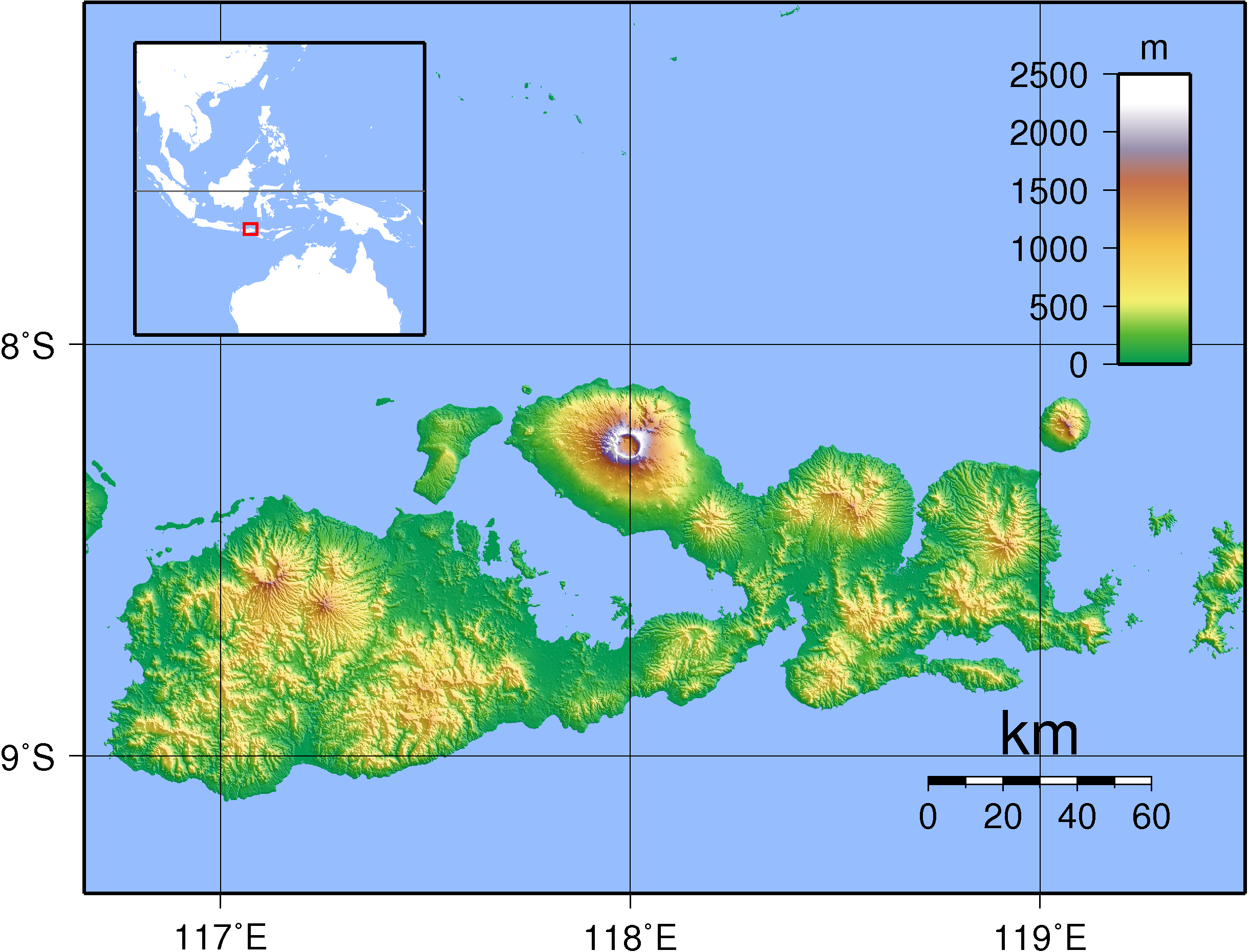
| Description |
Topographic map of Sumbawa, Indonesia. Created with GMT from SRTM data. |
|---|---|
| Source |
self-made |
| Date |
Sep 11, 2007 |
| Author | |
| Permission (Reusing this image) |
see below |
[edit] Licensing

Historial del fitxer
Cliqueu sobre la data/hora per veure el fitxer tal com era aleshores.
| Data/Hora | Dimensions | Usuari | Comentari | |
|---|---|---|---|---|
| actual | 22:38, 11 set 2007 | 2.440×1.860 (1,91 MB) | Sadalmelik | ({{Information |Description=Topographic map of Sumbawa, Indonesia. Created with GMT from SRTM data. |Source=self-made |Date=Sep 11, 2007 |Author= Sadalmelik }} Category:Maps of Indonesia Category:Topographic maps of Asia) |
Enllaços a la imatge
Les següents pàgines enllacen a aquesta imatge:

