Imatge:Russia-CIA WFB Map--Tunguska.png
De Viquipèdia
No hi ha una versió amb una resolució més gran.
Russia-CIA_WFB_Map--Tunguska.png (634 × 323 píxels, mida de l'arxiu: 31 KB, tipus MIME: image/png)
| | Aquest arxiu és una càrrega compartida, extreta del projecte Wikimedia Commons i pot ser usada per altres projectes. Si voleu disposar de més informació sobre el fitxer, podeu visitar la pàgina original |
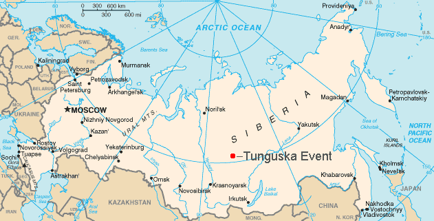
Map showing the approximate location of the Tunguska event of 1908.

This is a hacked version of the public domain map Russia-CIA WFB Map.png. User:Bobby D. Bryant made the modifications and uploaded it under the GFDL on May 21, 2005.
Historial del fitxer
Cliqueu sobre la data/hora per veure el fitxer tal com era aleshores.
| Data/Hora | Dimensions | Usuari | Comentari | |
|---|---|---|---|---|
| actual | 18:09, 11 set 2006 | 634×323 (31 KB) | Amic | ({{Information |Description=Map showing the approximate location of the Tunguska event of 1908. |Source=This is a hacked version of the public domain map Russia-CIA WFB Map.png. [[w:User:Bobby D. Bryant|User:Bobby D. Bryan) |
| 17:35, 21 maig 2005 | 634×323 (29 KB) | Bobby D. Bryant | ({{CIA-map}}) |
Enllaços a la imatge
Les següents pàgines enllacen a aquesta imatge:

