Imatge:Romia Imperio.png
De Viquipèdia
Mida d'aquesta previsualització: 800 × 548 píxels
Imatge en màxima resolució (1.600 × 1.096 píxels, mida de l'arxiu: 52 KB, tipus MIME: image/png)
| | Aquest arxiu és una càrrega compartida, extreta del projecte Wikimedia Commons i pot ser usada per altres projectes. Si voleu disposar de més informació sobre el fitxer, podeu visitar la pàgina original |
[edit] Summary
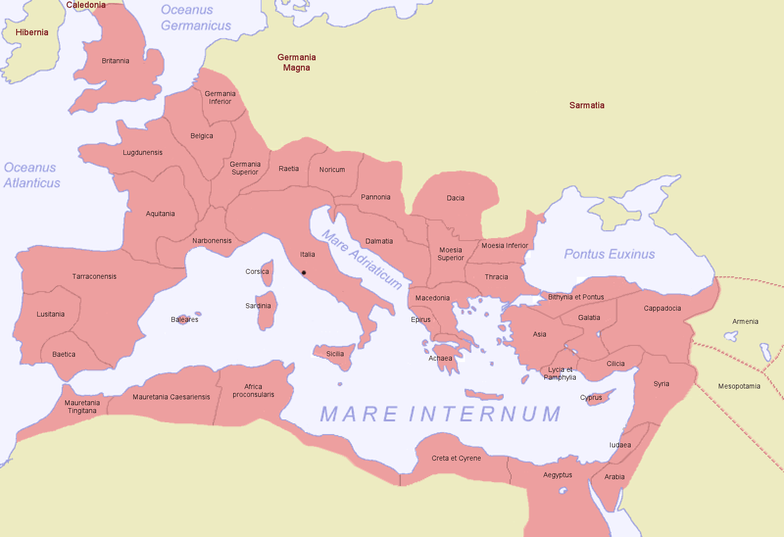
Basis · Grundlage · bazo: The file Image:Roman Empire Map.png (creator: Jani Niemenmaa, 2004), which had a digital watermark (a copyright sign), requested to be removed. Additionally, "Achaia" was changed to "Achaea", Terraconensis to Tarraconensis (borders fixed), the borders of Africa and Asia were corrected. There is a second file Image:Romia Imperio sen provinconomoj.png without names of provinces, which is the basis for several locator maps of roman provinces.
Modification · Bearbeitung · prilaboro: ThomasPusch (june 2007)
See also: Map of the Roman Empire and Germania Magna in 116.

Historial del fitxer
Cliqueu sobre la data/hora per veure el fitxer tal com era aleshores.
| Data/Hora | Dimensions | Usuari | Comentari | |
|---|---|---|---|---|
| actual | 07:33, 29 juny 2007 | 1.600×1.096 (52 KB) | ThomasPusch | (Name of "Mauretania Caesariensis'' (one "s" was missing) corrected - nomo de "Mauretania Caesariensis'' korektita) |
| 11:27, 24 juny 2007 | 1.600×1.096 (52 KB) | ThomasPusch | (Borders of ''Africa'' and ''Asia'' corrected - Limoj de ''Afriko'' kaj ''Azio'' korektitaj) | |
| 07:45, 20 juny 2007 | 800×548 (45 KB) | ThomasPusch | (Tarragonensis corrected/berichtigt/korektita) | |
| 08:28, 16 juny 2007 | 800×548 (46 KB) | ThomasPusch | (== {{int:filedesc}} == {{en:Map of the Roman Empire during 116}} {{de:Karte des Römischen Reichs von 116}} {{eo:Mapo de la Romia Imperio de 116}} '') |
Enllaços a la imatge
Les següents pàgines enllacen a aquesta imatge:

