Imatge:Ph locator map palawan.png
De Viquipèdia
No hi ha una versió amb una resolució més gran.
Ph_locator_map_palawan.png (300 × 440 píxels, mida de l'arxiu: 19 KB, tipus MIME: image/png)
| | Aquest arxiu és una càrrega compartida, extreta del projecte Wikimedia Commons i pot ser usada per altres projectes. Si voleu disposar de més informació sobre el fitxer, podeu visitar la pàgina original |
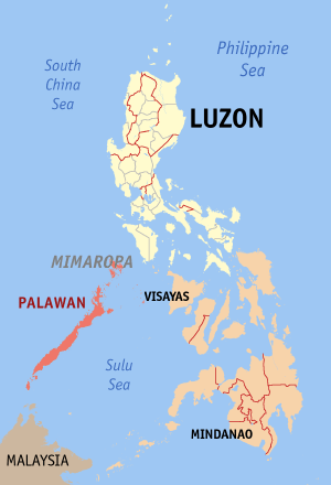
Map of the Philippines showing the location of Palawan.
Created and copyright (2003) by seav. Released under the GNU FDL.

Historial del fitxer
Cliqueu sobre la data/hora per veure el fitxer tal com era aleshores.
| Data/Hora | Dimensions | Usuari | Comentari | |
|---|---|---|---|---|
| actual | 15:53, 30 des 2005 | 300×440 (19 KB) | Magalhães | (Map of the Philippines showing the location of Palawan. Created and copyright (2003) by seav. Released under the GNU FDL.) |
| 22:45, 18 ago 2005 | 300×450 (15 KB) | Gildemax | (Map of the Philippines showing the location of Palawan. Map of the Philippines showing the location of Palawan. Created and copyright (2003) by en:user:]seavReleased under the GNU FDL. Source: http://en.wikipedia.org/wiki/Image:Ph_locator_map_pal) |
Enllaços a la imatge
Les següents pàgines enllacen a aquesta imatge:

