Imatge:Maps ams contai india nf-45-11-4.jpg
De Viquipèdia

Mida d'aquesta previsualització: 795 × 599 píxels
Imatge en màxima resolució (5.000 × 3.770 píxels, mida de l'arxiu: 1,32 MB, tipus MIME: image/jpeg)
| | Aquest arxiu és una càrrega compartida, extreta del projecte Wikimedia Commons i pot ser usada per altres projectes. Si voleu disposar de més informació sobre el fitxer, podeu visitar la pàgina original |
[edit] Summary
| Description |
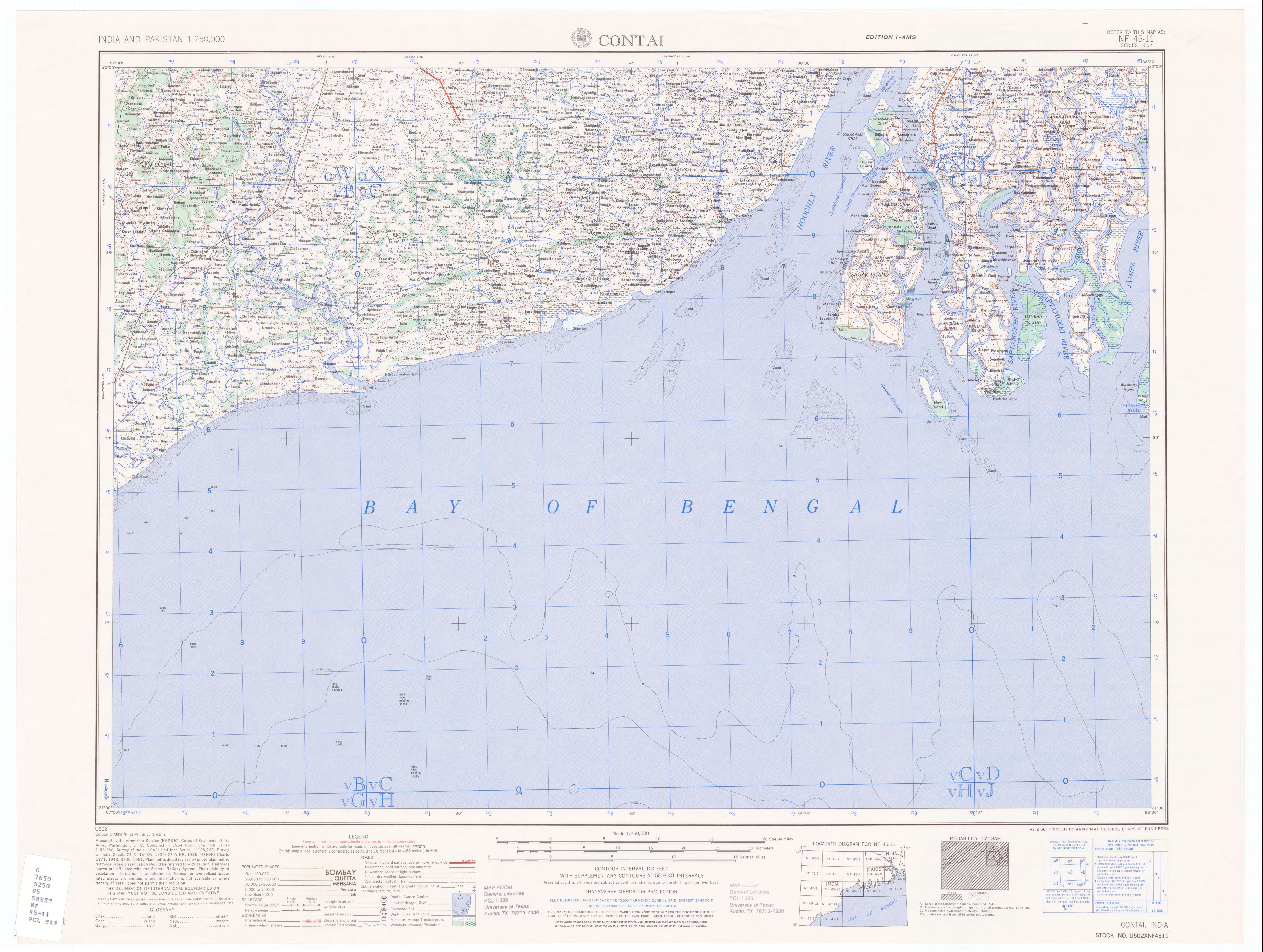
50% quality copy of Contai, India map by U.S. Army Map Service. Compiled in 1954. |
|---|---|
| Source |
http://www.lib.utexas.edu/maps/ams/india/nf-45-11.jpg linked from http://www.lib.utexas.edu/maps/ams/india/ |
| Date | |
| Author |
U.S. Army Map Service, Corps of Engineers |
| Permission (Reusing this image) |
PD U.S. Government work. "Courtesy of the University of Texas Libraries, The University of Texas at Austin." |
Note: This is not a copyright tag! Many images that use this tag are likely to be in the public domain, but many images, like for example images from WWII taken by members of the axis powers are not. Images must contain a valid copyright tag in addition to this one! For example:
or any other appropriate license tag. |
|
| This image is a copy of nf-45-11.jpg, a map from the map collection of the Perry-Castañeda Library (PCL) of the University of Texas at Austin. According to the FAQs it might be in the public domain, but please provide additional proof for that. | |
[edit] Licensing
| This work is in the public domain in the United States because it is a work of the United States Federal Government under the terms of Title 17, Chapter 1, Section 105 of the US Code. See Copyright.
Note: This only applies to works of the Federal Government and not to the work of any individual U.S. state, territory, commonwealth, county, municipality, or any other subdivision. العربية | Български | Česky | Deutsch | English | Español | Français | Magyar | Italiano | 日本語 | 한국어 | Polski | Português | 中文(繁體) | 中文(简体) | +/- |
 |
Historial del fitxer
Cliqueu sobre la data/hora per veure el fitxer tal com era aleshores.
| Data/Hora | Dimensions | Usuari | Comentari | |
|---|---|---|---|---|
| actual | 09:44, 10 gen 2007 | 5.000×3.770 (1,32 MB) | SEWilco | ({{Information |Description=50% quality copy of Contai, India map by U.S. Army Map Service. Compiled in 1954. |Source=http://www.lib.utexas.edu/maps/ams/india/nf-45-11.jpg linked from http://www.lib.utexas.edu/maps/ams/india/ |Date= |Author=U.S. Army Map ) |
Enllaços a la imatge
Les següents pàgines enllacen a aquesta imatge:

