Imatge:Map of USA highlighting Pennsylvania.png
De Viquipèdia
No hi ha una versió amb una resolució més gran.
Map_of_USA_highlighting_Pennsylvania.png (280 × 183 píxels, mida de l'arxiu: 35 KB, tipus MIME: image/png)
| | Aquest arxiu és una càrrega compartida, extreta del projecte Wikimedia Commons i pot ser usada per altres projectes. Si voleu disposar de més informació sobre el fitxer, podeu visitar la pàgina original |
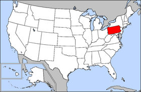
Русский: Картa США с выделенной Пенсильванией
Public domain map courtesy of The General Libraries, The University of Texas at Austin, modified to highlight state boundaries.

Historial del fitxer
Cliqueu sobre la data/hora per veure el fitxer tal com era aleshores.
| Data/Hora | Dimensions | Usuari | Comentari | |
|---|---|---|---|---|
| actual | 01:11, 6 gen 2005 | 280×183 (35 KB) | Emhoo | (Public domain map courtesy of [http://www.lib.utexas.edu/ The General Libraries, The University of Texas at Austin], modified to highlight state boundaries. {{GFDL}}) |
Enllaços a la imatge
Les següents pàgines enllacen a aquesta imatge:

