Imatge:Map of USA highlighting Florida.png
De Viquipèdia
No hi ha una versió amb una resolució més gran.
Map_of_USA_highlighting_Florida.png (280 × 183 píxels, mida de l'arxiu: 45 KB, tipus MIME: image/png)
| | Aquest arxiu és una càrrega compartida, extreta del projecte Wikimedia Commons i pot ser usada per altres projectes. Si voleu disposar de més informació sobre el fitxer, podeu visitar la pàgina original |
 A vector version of this image (SVG) is available. For more information about vector graphics, read about Commons transition to SVG. Български | Deutsch | English | Español | Français | Galego | עברית | Magyar | Bahasa Indonesia | Italiano | 日本語 | 한국어 | Lietuvių | Polski | Português | Русский | Српски / Srpski | Українська | 中文(简体) | 中文(繁體) | +/- |
 |
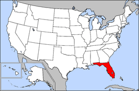
From English Wikipedia.
Public domain map courtesy of The General Libraries, The University of Texas at Austin, modified to highlight state boundaries.

Historial del fitxer
Cliqueu sobre la data/hora per veure el fitxer tal com era aleshores.
| Data/Hora | Dimensions | Usuari | Comentari | |
|---|---|---|---|---|
| actual | 23:56, 28 març 2005 | 280×183 (45 KB) | David | (From English Wikipedia: Public domain map courtesy of [http://www.lib.utexas.edu/ The General Libraries, The University of Texas at Austin], modified to highlight state boundaries. {{GFDL}} Category:State locator maps of the United States) |
Enllaços a la imatge
Les següents pàgines enllacen a aquesta imatge:

