Imatge:Manhattan Project US Map.png
De Viquipèdia
Mida d'aquesta previsualització: 800 × 494 píxels
Imatge en màxima resolució (1.000 × 618 píxels, mida de l'arxiu: 44 KB, tipus MIME: image/png)
| | Aquest arxiu és una càrrega compartida, extreta del projecte Wikimedia Commons i pot ser usada per altres projectes. Si voleu disposar de més informació sobre el fitxer, podeu visitar la pàgina original |
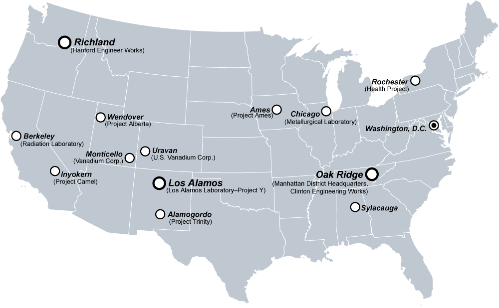
A selection of major United States sites in the Manhattan Project.
Created by Fastfission in Adobe Illustrator.
[edit] Licensing
| This image has been released into the public domain by its author, Fastfission. This applies worldwide. In some countries this may not be legally possible; if so: العربية | Български | Deutsch | Ελληνικά | English | Español | Français | Italiano | 日本語 | 한국어 | Polski | Русский | Српски / Srpski | Svenska | தமிழ் | Українська | 中文(繁體) | 中文(简体) +/- |
If you want to credit someone, credit "Wikimedia Commons." Otherwise don't credit anyone, that's fine by me. --Fastfission 15:01, 14 April 2008 (UTC)
[edit] Related
[edit] Upload history at other wikipedias
- WP:EN
- 20:52, 11 Dec 2004 . . Fastfission (44787 bytes) (Major United States sites in the Manhattan Project. Created by User:Fastfission in Adobe Illustrator)
Historial del fitxer
Cliqueu sobre la data/hora per veure el fitxer tal com era aleshores.
| Data/Hora | Dimensions | Usuari | Comentari | |
|---|---|---|---|---|
| actual | 21:01, 20 ago 2005 | 1.000×618 (44 KB) | Dake | (A selection of major United States sites in the Manhattan Project. Created by en:User:Fastfission in Adobe Illustrator. {{GFDL}} Category:U.S. history images) |
| 23:13, 20 gen 2005 | 1.000×618 (44 KB) | Get It | (will add info after upload) |
Enllaços a la imatge
Les següents pàgines enllacen a aquesta imatge:

