Imatge:Karte Deutschland.png
De Viquipèdia
No hi ha una versió amb una resolució més gran.
Karte_Deutschland.png (188 × 235 píxels, mida de l'arxiu: 2 KB, tipus MIME: image/png)
| | Aquest arxiu és una càrrega compartida, extreta del projecte Wikimedia Commons i pot ser usada per altres projectes. Si voleu disposar de més informació sobre el fitxer, podeu visitar la pàgina original |
| This high-risk image, which is widely used on Wikimedia projects, has been protected to prevent vandalism. Please discuss changes on the talk page or request unprotection. |
| Description |
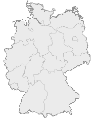
English: Map of Germany with the borders of the 16 federal states.
Deutsch: Karte von Deutschland mit den Grenzen der 16 Bundesländer.
|
|---|---|
| Source |
OpenGeoDB |
| Date |
? |
| Author |
NN/OpenGeoDB |
| Permission (Reusing this image) |
GFDL |
 |
Permission is granted to copy, distribute and/or modify this document under the terms of the GNU Free Documentation License, Version 1.2 or any later version published by the Free Software Foundation; with no Invariant Sections, no Front-Cover Texts, and no Back-Cover Texts. A copy of the license is included in the section entitled "Text of the GNU Free Documentation License".
This image was generated with http://opengeodb.hoppe-media.com/. Permission to use it under GFDL was given by its author Akl. |
 A vector version of this image (SVG) is available. For more information about vector graphics, read about Commons transition to SVG. Български | Deutsch | English | Español | Français | Galego | עברית | Magyar | Bahasa Indonesia | Italiano | 日本語 | 한국어 | Lietuvių | Polski | Português | Русский | Српски / Srpski | Українська | 中文(简体) | 中文(繁體) | +/- |
 |
Historial del fitxer
Cliqueu sobre la data/hora per veure el fitxer tal com era aleshores.
| Data/Hora | Dimensions | Usuari | Comentari | |
|---|---|---|---|---|
| actual | 20:46, 8 gen 2008 | 188×235 (2 KB) | Evilboy | (Reverted to version as of 20:35, 14 March 2007) |
| 22:35, 14 març 2007 | 188×235 (2 KB) | Tene | (Optimised (0)) | |
| 13:28, 9 feb 2007 | 188×235 (2 KB) | TM | (Contrast slightly improved without loosing precision) | |
| 21:04, 31 gen 2007 | 188×235 (2 KB) | Notschrei | (Auf eine alte Version zurückgesetzt) | |
| 20:17, 31 gen 2007 | 188×235 (8 KB) | Der Eberswalder | ||
| 14:29, 31 gen 2007 | 188×235 (2 KB) | Geograv | (Auf eine alte Version zurückgesetzt) | |
| 13:04, 31 gen 2007 | 188×235 (8 KB) | Der Eberswalder | (now white color outside the borders) | |
| 12:31, 31 gen 2007 | 188×235 (2 KB) | Siebrand | (Eerdere versie hersteld) | |
| 08:31, 31 gen 2007 | 188×235 (9 KB) | Der Eberswalder | (better viewable) | |
| 17:48, 27 ago 2006 | 188×235 (2 KB) | TM | (Slightly error corrected version, based on Image:Karte stralsund in deutschland-test.png by de:Benutzer:Rauenstein) | |
| 19:25, 23 ago 2005 | 188×235 (5 KB) | Winfried Gaenssler | (english: Germany<br> deutsch: Deutschland {{GFDL-OpenGeoDB}} de:Bild:Karte Deutschland.png category:Germany ) |

