Imatge:Habsburg Map 1547.jpg
De Viquipèdia
Mida d'aquesta previsualització: 800 × 498 píxels
Imatge en màxima resolució (1.654 × 1.029 píxels, mida de l'arxiu: 421 KB, tipus MIME: image/jpeg)
| | Aquest arxiu és una càrrega compartida, extreta del projecte Wikimedia Commons i pot ser usada per altres projectes. Si voleu disposar de més informació sobre el fitxer, podeu visitar la pàgina original |
[edit] Description
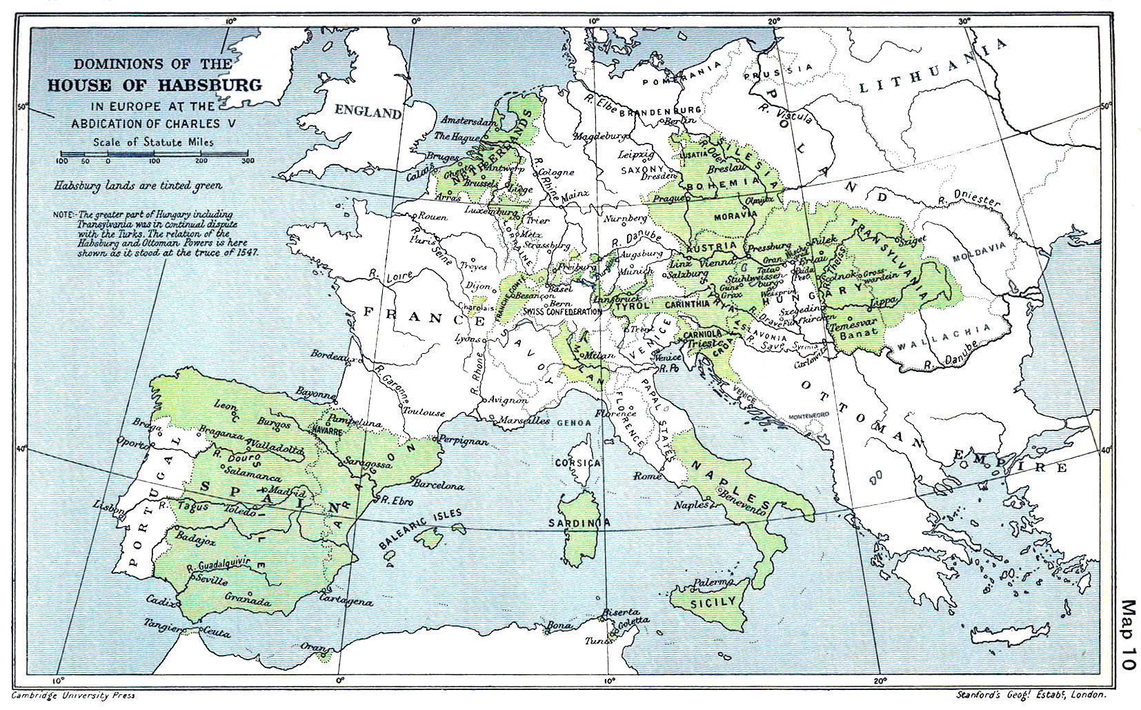
A map of the dominion of the Habsburgs following the Battle of Mühlberg (1547). Taken from The Cambridge Modern History Atlas, edited by Sir Adolphus William Ward, G.W. Prothero, Sir Stanley Mordaunt Leathes, and E.A. Benians. Cambridge University Press: London, 1912. A digitally clean up version of this map is "Habsburg Map 1547b.jpg"
[edit] Licensing
| This work is in the public domain in the United States because it was published before January 1, 1923.
Public domain works must be out of copyright in both the United States and in the source country of the work in order to be hosted on the Commons. If the work is not a U.S. work, the file must have an additional copyright tag indicating the copyright status in the source country. |
Historial del fitxer
Cliqueu sobre la data/hora per veure el fitxer tal com era aleshores.
| Data/Hora | Dimensions | Usuari | Comentari | |
|---|---|---|---|---|
| actual | 16:42, 28 juny 2005 | 1.654×1.029 (421 KB) | Rythin | (A map of the dominion of the Habsburgs following the Battle of Mühlberg (1547). Taken from ''The Cambridge Modern History Atlas,'' edited by Sir Adolphus William Ward, G.W. Prothero, Sir Stanley Mordaunt Leathes, and E.A. Benians. Cambridge University Pr) |
Enllaços a la imatge
Les següents pàgines enllacen a aquesta imatge:

