Imatge:Debris-LEO1280.jpg
De Viquipèdia
Mida d'aquesta previsualització: 600 × 600 píxels
Imatge en màxima resolució (1.280 × 1.280 píxels, mida de l'arxiu: 258 KB, tipus MIME: image/jpeg)
| | Aquest arxiu és una càrrega compartida, extreta del projecte Wikimedia Commons i pot ser usada per altres projectes. Si voleu disposar de més informació sobre el fitxer, podeu visitar la pàgina original |
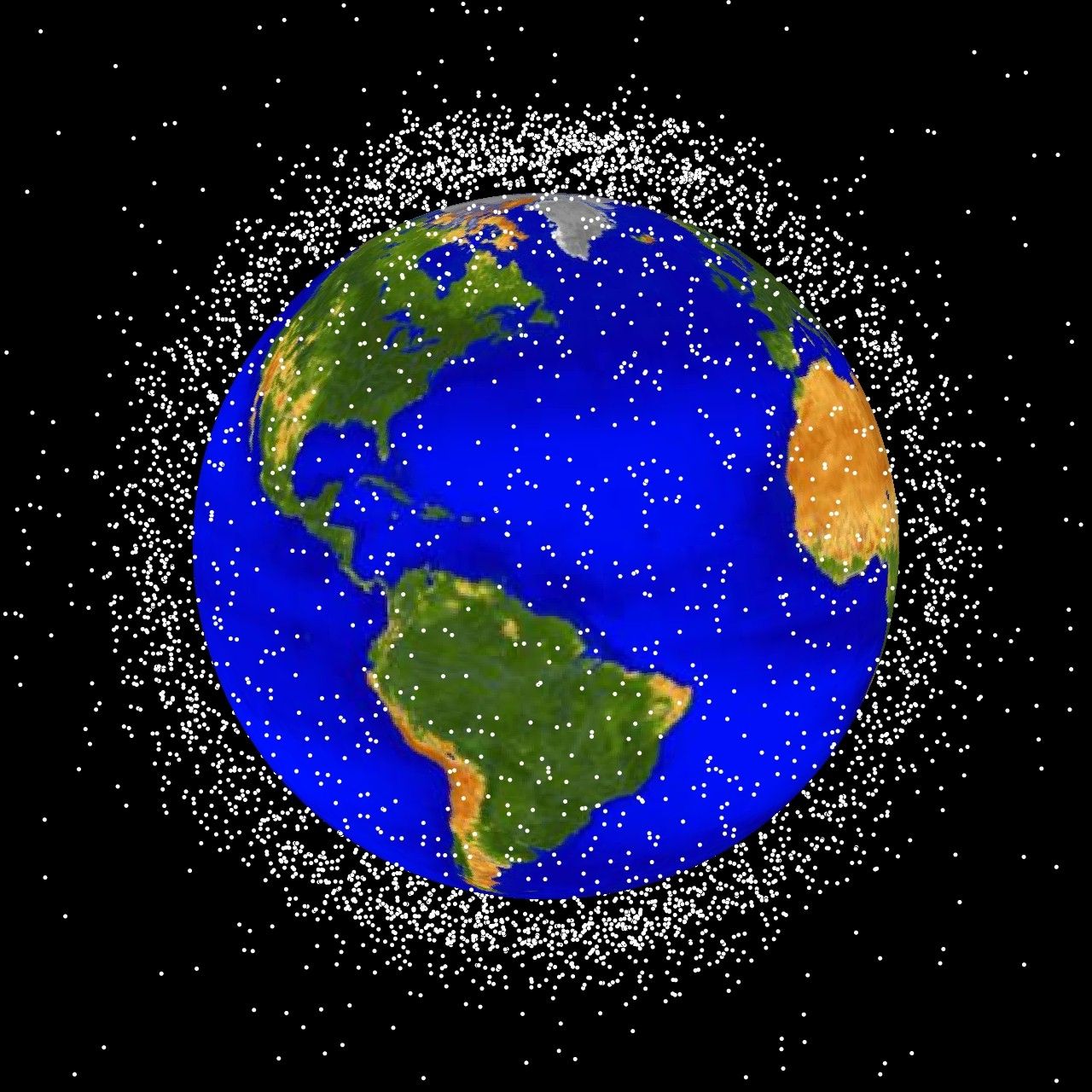
debris plot by NASA
Source: http://sn-callisto.jsc.nasa.gov/photogallery/beehives.html
|
|
This file is in the public domain because it was created by NASA. NASA copyright policy states that "NASA material is not protected by copyright unless noted". (NASA copyright policy page or JPL Image Use Policy).
Deutsch | English | Español | Français | Nederlands | Português | Русский | 中文(简体) | 中文(繁體) | +/- |
|
 |
Warnings:
|
Describtion: The following graphics are computer generated images of objects in Earth orbit that are currently being tracked. Approximately 95% of the objects in this illustration are orbital debris, i.e., not functional satellites. The dots represent the current location of each item. The orbital debris dots are scaled according to the image size of the graphic to optimize their visibility and are not scaled to Earth. These images provide a good visualization of where the greatest orbital debris populations exist. Below are the graphics generated from different observation points.
LEO stands for low Earth orbit and is the region of space within 2,000 km of the Earth's surface. It is the most concentrated area for orbital debris.
Historial del fitxer
Cliqueu sobre la data/hora per veure el fitxer tal com era aleshores.
| Data/Hora | Dimensions | Usuari | Comentari | |
|---|---|---|---|---|
| actual | 18:48, 1 feb 2005 | 1.280×1.280 (258 KB) | Srbauer | (debris plot by NASA) |
Enllaços a la imatge
Les següents pàgines enllacen a aquesta imatge:

