Imatge:Chukchi Sea map.png
De Viquipèdia
Mida d'aquesta previsualització: 800 × 448 píxels
Imatge en màxima resolució (1.200 × 672 píxels, mida de l'arxiu: 100 KB, tipus MIME: image/png)
| | Aquest arxiu és una càrrega compartida, extreta del projecte Wikimedia Commons i pot ser usada per altres projectes. Si voleu disposar de més informació sobre el fitxer, podeu visitar la pàgina original |
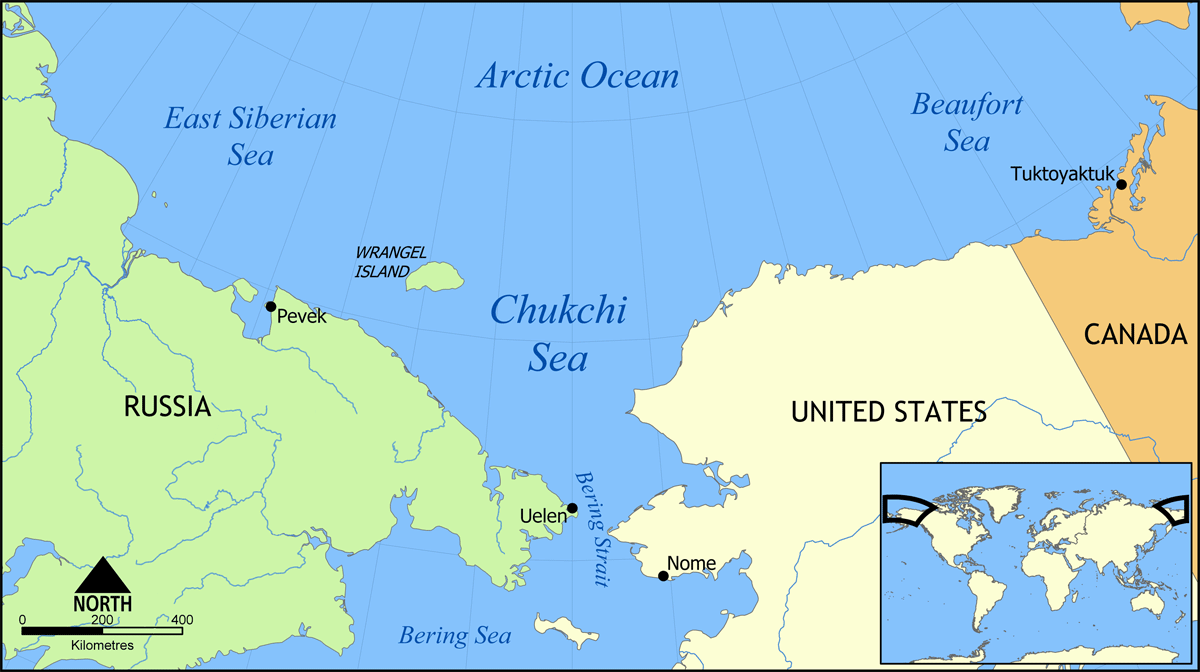
Map showing the Chukchi Sea, north of the Bering Strait and Sea, between Russia and the United States.
Created by NormanEinstein, May 31, 2006.
See also Image:Chukchi Sea map-fr.svg

Historial del fitxer
Cliqueu sobre la data/hora per veure el fitxer tal com era aleshores.
| Data/Hora | Dimensions | Usuari | Comentari | |
|---|---|---|---|---|
| actual | 16:33, 31 maig 2006 | 1.200×672 (100 KB) | NormanEinstein | (Map showing the Chukchi Sea, north of the Bering Strait and Sea, between Russia and the United States. Created by NormanEinstein, May 31, 2006. {{GFDL-self}} Category:Maps of seas) |
Enllaços a la imatge
Les següents pàgines enllacen a aquesta imatge:

