Imatge:Cape Helles landing map.jpg
De Viquipèdia
Mida d'aquesta previsualització: 789 × 599 píxels
Imatge en màxima resolució (845 × 642 píxels, mida de l'arxiu: 63 KB, tipus MIME: image/jpeg)
| | Aquest arxiu és una càrrega compartida, extreta del projecte Wikimedia Commons i pot ser usada per altres projectes. Si voleu disposar de més informació sobre el fitxer, podeu visitar la pàgina original |
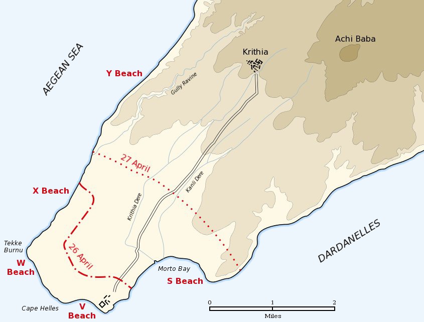
Map of the landing of the British 29th Division at Cape Helles on April 25, 1915 during the Battle of Gallipoli. The front line established by the night of April 26 is shown by the red dash-dot line. The front line reached by the night of April 27 is shown by the red dotted line. This became the "jumping off" line for the First Battle of Krithia.
| This image has been released into the public domain by its author, Gsl. This applies worldwide. In some countries this may not be legally possible; if so: العربية | Български | Deutsch | Ελληνικά | English | Español | Français | Italiano | 日本語 | 한국어 | Polski | Русский | Српски / Srpski | Svenska | தமிழ் | Українська | 中文(繁體) | 中文(简体) +/- |
Historial del fitxer
Cliqueu sobre la data/hora per veure el fitxer tal com era aleshores.
| Data/Hora | Dimensions | Usuari | Comentari | |
|---|---|---|---|---|
| actual | 17:04, 6 maig 2005 | 845×642 (63 KB) | Anathema | (Map of the landing of the British 29th Division at Cape Helles, Gallipoli, on April 25, 1915. The front line established by the night of April 26 is shown by the red dash-dot line. The front line reached by the night of April 27 is shown by the red ) |
Enllaços a la imatge
Les següents pàgines enllacen a aquesta imatge:

