Imatge:Buskerud Municipalities.png
De Viquipèdia
Mida d'aquesta previsualització: 800 × 487 píxels
Imatge en màxima resolució (1.025 × 624 píxels, mida de l'arxiu: 19 KB, tipus MIME: image/png)
| | Aquest arxiu és una càrrega compartida, extreta del projecte Wikimedia Commons i pot ser usada per altres projectes. Si voleu disposar de més informació sobre el fitxer, podeu visitar la pàgina original |
La bildo estas kopiita de wikipedia:en. La originala priskribo estas:
[edit] Summary
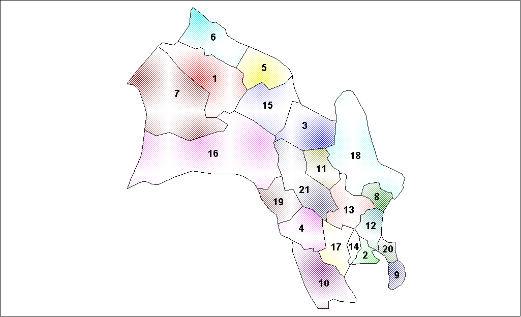
Map of the municipalities of Buskerud County in Norway. Created by Rarelibra for public domain use. Created using MapInfo Professional v7.5 and various mapping resources.
[edit] Licensing
| I, the copyright holder of this work, hereby release it into the public domain. This applies worldwide. In case this is not legally possible: Afrikaans | Alemannisch | Aragonés | العربية | Asturianu | Български | Català | Česky | Cymraeg | Dansk | Deutsch | Eʋegbe | Ελληνικά | English | Español | Esperanto | Euskara | Estremeñu | فارسی | Français | Galego | 한국어 | हिन्दी | Hrvatski | Ido | Bahasa Indonesia | Íslenska | Italiano | עברית | Kurdî / كوردی | Latina | Lietuvių | Latviešu | Magyar | Македонски | Bahasa Melayu | Nederlands | Norsk (bokmål) | Norsk (nynorsk) | 日本語 | Polski | Português | Ripoarisch | Română | Русский | Shqip | Slovenčina | Slovenščina | Српски / Srpski | Svenska | ไทย | Tagalog | Türkçe | Українська | Tiếng Việt | Walon | 中文(简体) | 中文(繁體) | zh-yue-hant | +/- |
| date/time | username | edit summary |
|---|---|---|
| 19:48, 26 January 2006 | en:User:Rarelibra | (Map of the municipalities of Buskerud County in Norway. Created by <a href="/wiki/User:Rarelibra" title="User:Rarelibra">Rarelibra</a> for public domain use. Created using MapInfo Professional v7.5 and various mapping resources.) |
[edit] Historio de la dosiero
Legend: (cur) = this is the current file, (del) = delete this old version, (rev) = revert to this old version.
Click on date to download the file or see the image uploaded on that date.
- (del) (cur) 19:48, 26 January 2006 . . en:User:Rarelibra Rarelibra ( en:User_talk:Rarelibra Talk) . . 1025x624 (19651 bytes) (Map of the municipalities of Buskerud County in Norway. Created by en:User:Rarelibra Rarelibra for public domain use. Created using MapInfo Professional v7.5 and various mapping resources.)
Historial del fitxer
Cliqueu sobre la data/hora per veure el fitxer tal com era aleshores.
| Data/Hora | Dimensions | Usuari | Comentari | |
|---|---|---|---|---|
| actual | 23:10, 3 ago 2007 | 1.025×624 (19 KB) | Rarelibra | (Map of the municipalities of Buskerud County in Norway. Created by Rarelibra for public domain use. Created using MapInfo Professional v7.5 and various mapping resources. ) |
| 14:23, 26 març 2006 | 1.025×624 (19 KB) | Maksim | (La bildo estas kopiita de wikipedia:en. La originala priskribo estas: == Summary == Map of the municipalities of Buskerud County in Norway. Created by Rarelibra for public domain use. Created using MapInfo Professional v7.5 and various) |
Enllaços a la imatge
Les següents pàgines enllacen a aquesta imatge:

