White Cliffs of Dover
About this schools Wikipedia selection
This Wikipedia selection is available offline from SOS Children for distribution in the developing world. See http://www.soschildren.org/sponsor-a-child to find out about child sponsorship.
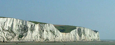
The white cliffs of Dover are cliffs which form part of the British coastline facing the Strait of Dover and France. The cliffs are part of the North Downs formation. The cliff face, which reaches up to 106 metres high, owes its striking façade to its composition of chalk (pure white calcium carbonate) accentuated by streaks of black flint. The cliffs spread east and west from the town of Dover in the county of Kent, an ancient and still important English port.
The cliffs have great symbolic value for Britain because they face towards Continental Europe across the narrowest part of the English Channel, where invasions have historically threatened and against which the cliffs form a symbolic guard. Because crossing at Dover was the primary route to the continent before air travel, the white line of cliffs also formed the first (or last) sight of the UK for travellers.
Location
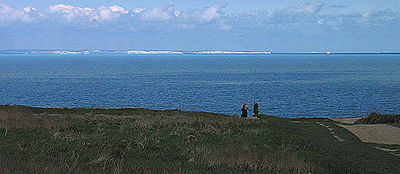
The cliffs are located along the coastline between approximately: Latitude 51°06'N, Longitude 1°14'E and Latitude 51°12'N, Longitude 1°24'E. Shakespeare Cliff marks the point where England most closely approaches continental Europe. On a clear day, the cliffs are easily visible from the French coast.
Geology
The cliffs are composed mainly of coccoliths and trace their origins to the Cretaceous Period, approximately 136 million years ago, when the area between Britain in the west and Sweden/Poland in the east was submerged under deep tropical waters. The emptied skeletons of coral, sponges and other small sea creatures fell as sediment and began to accumulate on the ocean floor. By approximately 70 million years ago, this process had formed a mass of silica-specked chalk covering huge areas between Britain and the Baltic Sea — white cliffs like those of Dover (but smaller) are also found on the Danish islands of Mon and Langeland or the coasts of the island of Rügen in Germany. The chalk layer used to lay high above sea level during the ice ages and in many places additionally was covered with glaciers. After the ice ages, they were exposed to the rising sea. Owing to the exceptional softness of chalk, tidal forces have since then significantly eroded this land mass away in Dover to form the English Channel.
The cliff face continues to erode at an average rate of one centimetre per year, although occasionally— most recently in 2001— large chunks of the edge, up to several metres at once, will fall into the channel with little warning. Visitors are, therefore, urged to remain at least five metres back from the edge.
Ecology
Several species of cliff nesting birds nest on the cliff face, including, fulmar and colonies of Black-legged Kittiwake. However, contrary to the words of the famous song ("There'll be bluebirds over the white cliffs of Dover"), bluebirds are an American species not found in the UK.
Defence
Behind the cliff face are miles of hidden tunnels that were created during the Middle Ages and later played a role in the defence of Britain during the Napoleonic Wars. The tunnels were later enlarged to become the Secret Wartime Tunnels beneath Dover castle.


