
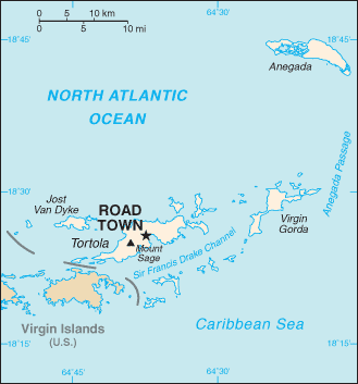
File:BritishVirginIsland map.png
BritishVirginIsland_map.png (329 × 353 pixels, file size: 23 KB, MIME type: image/png)
| |
This is a file from the Wikimedia Commons. Information from its description page there is shown below.
Commons is a freely licensed media file repository. You can help. |
- description : Map of British Virgin Island
- Author : CIA World Factbook
 |
This image is in the public domain because it contains materials that originally came from the United States Central Intelligence Agency's World Factbook.
|
 |
File usage
The following pages on Schools Wikipedia link to this image (list may be incomplete):
Learn more about Schools Wikipedia
SOS Childrens Villages chose the best bits of Wikipedia to help you learn. In 133 nations around the world, SOS Children's Villages works to bring better education and healthcare to families in desperate need of support. Why not try to learn more about child sponsorship?