
File:Angola Map.jpg
Size of this preview: 386 × 480 pixels.
| |
This is a file from the Wikimedia Commons. Information from its description page there is shown below.
Commons is a freely licensed media file repository. You can help. |
| Description |
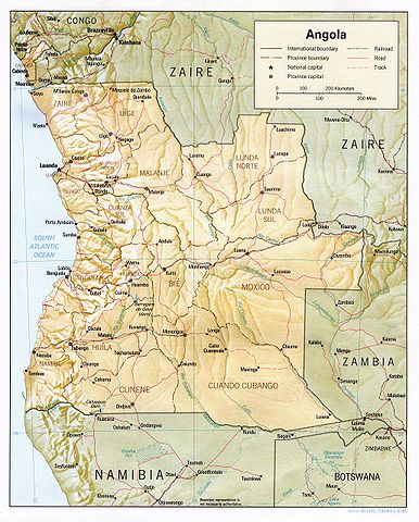
English: Shaded relief map of Angola.
|
|||
| Date | 1990 | |||
| Source | from the Perry-Castañeda Library Map Collection. | |||
| Author | CIA | |||
| Permission ( Reusing this file) |
|


File usage
The following pages on Schools Wikipedia link to this image (list may be incomplete):
A background to Schools Wikipedia
Wikipedia for Schools was collected by SOS Children. Our 500 Children's Villages provide a home for thousands of vulnerable children. Beyond our Villages, we support communities, helping local people establish better schools and delivering effective medical care to vulnerable children. Have you heard about child sponsorship? Visit our web site to find out.