
File:Cross Fell summit.jpg
Cross_Fell_summit.jpg (640 × 426 pixels, file size: 112 KB, MIME type: image/jpeg)
| |
This is a file from the Wikimedia Commons. Information from its description page there is shown below.
Commons is a freely licensed media file repository. You can help. |
|
Camera location |
|
This and other images at their locations on: Google Maps - Google Earth - OpenStreetMap | ( Info) |
|---|
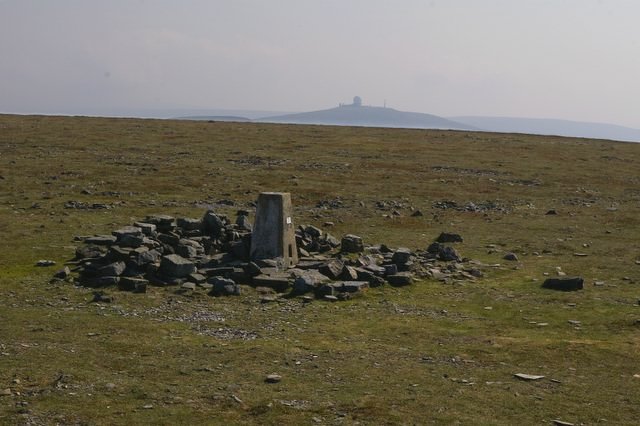
| Description | Cross Fell summit, looking to Great Dun Fell. Brightness and contrast have been increased from the original image. | ||
| Date | 2006-09-16 | ||
| Source |
|
||
| Author | Charles Rispin | ||
| Permission ( Reusing this file) |
Stated on the source page. |

Licensing
| This file is licensed under the Creative Commons Attribution-Share Alike 2.0 Generic license. | ||
|
File usage
The following pages on Schools Wikipedia link to this image (list may be incomplete):
Metadata
Wikipedia for Schools...
Through Schools Wikipedia, SOS Children's Villages has brought learning to children around the world. Our 500 Children's Villages provide a home for thousands of vulnerable children. Beyond our Villages, we support communities, helping local people establish better schools and delivering effective medical care to vulnerable children. Have you thought about sponsoring a child?