 |
This is a file from the Wikimedia Commons. Information from its description page there is shown below.
Commons is a freely licensed media file repository. You can help.
|
 |
This is an image of a place or building that is listed on the National Register of Historic Places in the United States. Its reference number is 77001443.
|
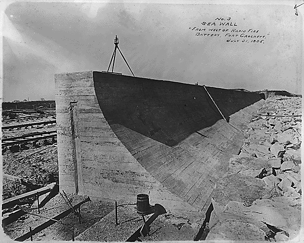
Seawall of Galveston, Texas, under construction, 1905
Creator: War Department. Office of the Chief of Engineers.~. Galveston District. (02/25/1880 - 02/01/1941) ( Most Recent)
Summary
Type of Archival Materials: Textual Records Level of Description: Item from Record Group 77: Records of the Office of the Chief of Engineers, 1789 - 1988
Location: NARA's Southwest Region (Fort Worth) (NRFFA), 501 West Felix Street, Building 1, Fort Worth, TX 76115-3405 PHONE: 817-831-5620, FAX: 817-334-5621, EMAIL: ftworth.archives@nara.gov Production Date: 07/31/1905
Part of: File Unit: Photographs of Projects, 1900 - 1953
Access Restrictions: Unrestricted
Use Restrictions: Unrestricted
Variant Control Number(s): Other Identifier: Box 1 NAIL Control Number: NRFF-77-G13-CROCKETT-1(4)
http://arcweb.archives.gov/arc/arch_results_detail.jsp?&pg=26&si=0&st=b&rp=details&nh=56
Licensing
| Public domainPublic domainfalsefalse |
|
|
This media file is in the public domain in the United States. This applies to U.S. works where the copyright has expired, often because its first publication occurred prior to January 1, 1923. See this page for further explanation.
|
|
|
|
This image might not be in the public domain outside of the United States; this especially applies in the countries and areas that do not apply the rule of the shorter term for US works, such as Canada, Mainland China (not Hong Kong or Macao), Germany, Mexico, and Switzerland. The creator and year of publication are essential information and must be provided. See Wikipedia:Public domain and Wikipedia:Copyrights for more details. |
|
|
Object location
|
29° 18′ 9.00″ N, 94° 46′ 27.00″ W
|
This and other images at their locations on: Google Maps - Google Earth - OpenStreetMap - Proximityrama |
( Info)29.3025;-94.774167 |
File usage
The following pages on Schools Wikipedia link to this image (list may be incomplete):
Schools Wikipedia was launched to make learning available to everyone. In 133 nations around the world, SOS Children's Villages works to bring better education and healthcare to families in desperate need of support. Sponsoring a child is the coolest way to help.


