
File:Airspace of Mumbai 1.jpg
Size of this preview: 640 × 480 pixels.
| |
This is a file from the Wikimedia Commons. Information from its description page there is shown below.
Commons is a freely licensed media file repository. You can help. |
Summary
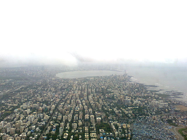
| Description |
English: Taken after take-off from Mumbai International Airport. Seen below are the western parts of suburbs of Vile Parle, Santa Cruz, Khar and Bandra. Seen in the extreme left is the Western Railway line which divides Mumbai's western suburbs into West and East, suffixed (W) and (E) respectively. The C shaped causeway marks the beginning of the city of Mumbai with areas like Mahim, Shivaji Park, Dadar and Worli. Also seen is the Bandra Worli sea link. Downtown Mumbai is approximately 15 kilometres from where the photo is taken.
|
| Date | 5 September 2010, 13:27:30 |
| Source | Own work |
| Author | PP Yoonus |
Licensing
|
File usage
The following pages on Schools Wikipedia link to this image (list may be incomplete):
Metadata
Find out about Schools Wikipedia
Schools Wikipedia was created by children's charity SOS Childrens Villages. SOS Childrens Villages helps more than 2 million people across 133 countries around the world. There are many ways to help with SOS Children.