
File:1700 CE world map.PNG
Size of this preview: 640 × 318 pixels.
| |
This is a file from the Wikimedia Commons. Information from its description page there is shown below.
Commons is a freely licensed media file repository. You can help. |
Summary
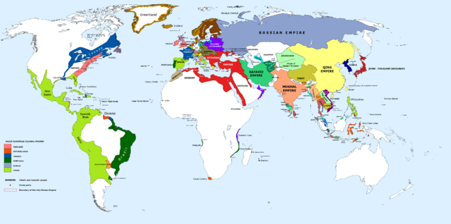
| Description |
English: 1700 AD: An illustrative map of the world in the early colonial period. The Mughal Empire in India is at its greatest territorial extent.
|
| Date | 13 January 2013, 10:50:59 |
| Source | Own work |
| Author | Urnanabha |
Licensing
|
File usage
The following pages on Schools Wikipedia link to this image (list may be incomplete):
Metadata
About Schools Wikipedia
Wikipedia for Schools was collected by SOS Children. More than 2 million people benefit from the global charity work of SOS Children's Villages, and our work in 133 countries around the world is vital to ensuring a better future for vulnerable children. Sponsoring a child is a great way to help children who need your support.