
File:Atlantic cable Map.jpg
| |
This is a file from the Wikimedia Commons. Information from its description page there is shown below.
Commons is a freely licensed media file repository. You can help. |
| Description |
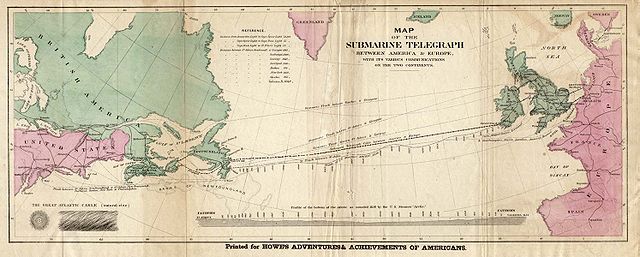
English: Map of the 1858 Atlantic Cable route (from http://atlantic-cable.com/Maps/index.htm).
Français : Carte des routes de câbles sous-marins transatlatiques de 1858.
Русский: Карта прокладки телеграфного кабеля через Атлантику в 1858 г.
|
| Date | the 1858 |
| Source | Howe's Adventures & Achievements of Americans; en:Image:Atlantic_cable_Map.jpg |
| Author | Unknown |
| Permission ( Reusing this file) |
Image is out of copyright, but the scan used here was sourced from http://atlantic-cable.com/Maps/index.htm without my permission (I am the site owner). I grant permission for use of the scan on Wikipedia. |
 |
This image (or other media file) is in the public domain because its copyright has expired. This applies to Australia, the European Union and those countries with a copyright term of life of the author plus 70 years.
|
|
|
|
File usage
Schools Wikipedia facts
Through Schools Wikipedia, SOS Children's Villages has brought learning to children around the world. Thanks to SOS Childrens Villages, 62,000 children are enjoying a happy childhood, with a healthy, prosperous future ahead of them. Help another child by taking out a sponsorship.