
File:Severn Bridge plaque - geograph.org.uk - 930373.jpg
Size of this preview: 584 × 480 pixels.
| |
This is a file from the Wikimedia Commons. Information from its description page there is shown below.
Commons is a freely licensed media file repository. You can help. |
Summary
| Description |
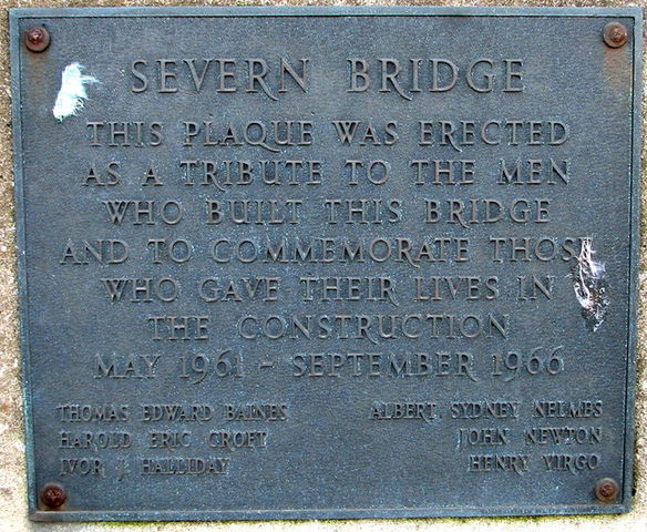
English: Severn Bridge plaque
|
| Date | 24 February 2007 |
| Source | From geograph.org.uk |
| Author | Roy Parkhouse |
|
Camera location |
|
This and other images at their locations on: Google Maps - Google Earth - OpenStreetMap | ( Info) |
|---|
Licensing
 |
This image was taken from the Geograph project collection. See this photograph's page on the Geograph website for the photographer's contact details. The copyright on this image is owned by Roy Parkhouse and is licensed for reuse under the Creative Commons Attribution-ShareAlike 2.0 license. |
| This file is licensed under the Creative Commons Attribution-Share Alike 2.0 Generic license. | ||
| Attribution: Roy Parkhouse | ||
|
File usage
The following pages on Schools Wikipedia link to this image (list may be incomplete):
Learn more
Schools Wikipedia has been carefully checked to give you the best learning experience. SOS Children's Villages works in 133 countries and territories across the globe, helps more than 62,000 children, and reaches over 2 million people in total. If you'd like to help, why not learn how to sponsor a child?